
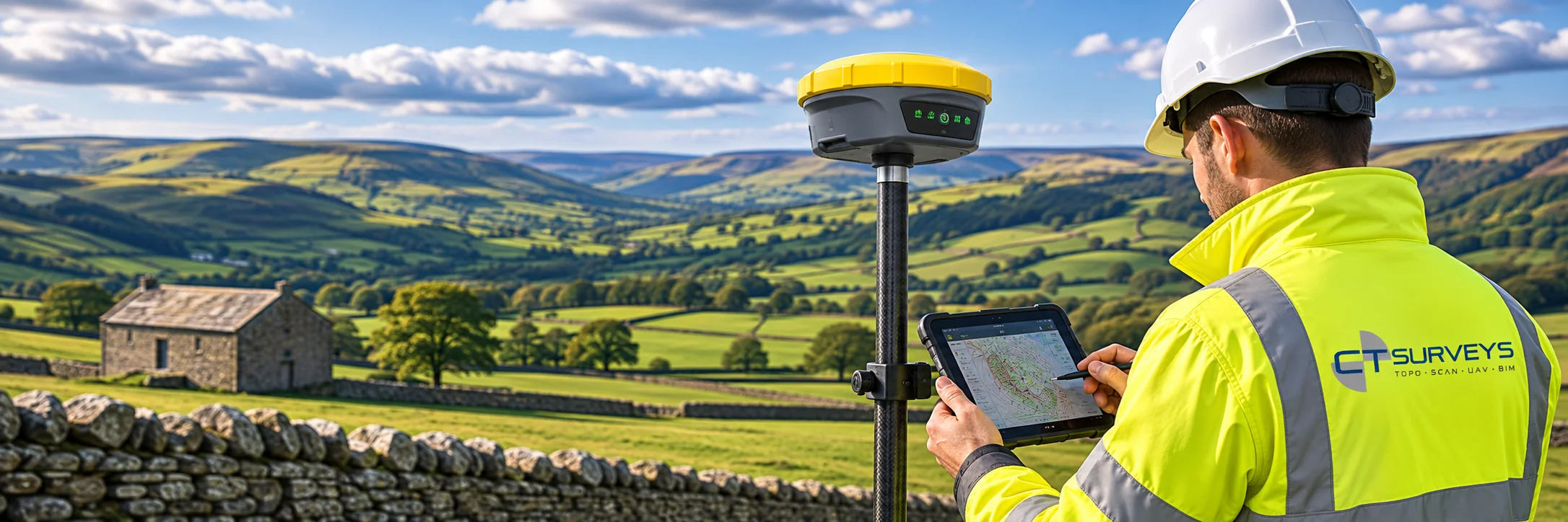
GPS Surveys
Survey control and ground data you can tie everything to.
We use RTK GPS equipment, including the GeoMax Zenith60 GNSS smart antenna, to establish accurate survey control and to capture levels and positions over open sites. It is the backbone of topographic, flood risk and setting-out work.
About This Service
GPS Surveys, explained
Real-time precision from satellites
GPS, more accurately GNSS, uses signals from satellite constellations to fix a position on the ground. Standard handheld GPS is accurate to metres. Surveying uses RTK, real-time kinematic correction, which brings that down to the centimetre level and delivers results straight away in the field.
We use the GeoMax Zenith60 GNSS smart antenna for this work, with built-in tilt compensation so points can be recorded quickly even when the pole is not perfectly level.
What GPS is used for
Survey control is the most important use. A network of accurately coordinated points on site gives every other measurement, whether from total station, scanner or drone, a common reference, tied to the Ordnance Survey National Grid and Datum.
GPS is also the efficient tool for open-ground topographic surveys, flood risk and watercourse cross-sections, setting out positions on site, and locating trial pits and boreholes from ground investigations so they appear in the right place on reports and drawings.
Where it needs help
GPS needs a clear view of the sky. Close to tall buildings, under tree canopy or in tunnels the signal degrades, so we pair GPS with total station measurements to carry control into those areas.
The choice of method is part of the planning we do before we arrive, so you get the accuracy your project requires without paying for more than you need.
Who It's For
Built around what you need
- 01
Engineers & consultants
Flood risk and levels data that is traceable to the National Grid and Datum.
- 02
Ground investigation firms
Trial pit and borehole locations recorded accurately for reporting.
- 03
Contractors & site managers
Control points for setting out and for tying other surveys together.
- 04
Landowners & developers
Boundary and level information across large, open sites.
Deliverables
What you receive
- Survey control points tied to Ordnance Survey National Grid
- Flood risk cross-sections and level surveys
- Trial pit and borehole location records
- Coordinates in CSV and CAD
- Control reports for use with other surveys
How It Works
From enquiry to delivered data
- 01
Plan the control
We choose the control layout and coordinate system for your site.
- 02
Observe
RTK GPS observations are taken with checks and repeat observations.
- 03
Process & check
Data is processed and validated against known stations.
- 04
Report
Coordinates and drawings are issued for use by your team.
FAQs
Common questions
Does GPS work everywhere?
RTK needs a clear view of the sky. Near tall buildings or tree cover we combine GPS with total station measurements.
Can you supply flood risk survey cross-sections?
Yes. We survey channels, banks and floodplain levels to the specification your consultant provides.
What coordinate systems do you provide?
Ordnance Survey National Grid and Datum as standard, or a local grid if required.
Get in Touch
Ready to Start
Your Project?
Tell us about your project and we'll get back to you with a tailored quote. No fixed daily rates — we price based on your specific requirements.
What to expect
- 01
Tell us about your project
Share your requirements, site details, and any drawings you have. We'll review everything before quoting.
- 02
We send a tailored quote
Pricing based on your specific needs — not generic day rates. Transparent and competitive.
- 03
We survey your site
Our qualified team arrive with the relevant equipment to carry out the survey.
- 04
Receive your survey data
Accurate CAD files, point cloud data, BIM models — delivered to your specification, on time.